
Discover the World: Engaging Geography Coloring Pages and Printables for Homeschool Educators
Are you a homeschooling parent or teacher constantly seeking innovative ways to make learning geography come alive for your children? Do you dream of instilling a genuine love for the world, its diverse cultures, and magnificent landscapes, but find traditional textbooks fall flat? You’re not alone. Many educators grapple with transforming abstract geographical concepts into tangible, exciting experiences for young learners. The good news is, there's a vibrant, hands-on solution that can revolutionize your approach to homeschool social studies: geography coloring page and printables.Imagine your child not just memorizing names on a map, but actively engaging with the shapes of continents and countries, tracing the vastness of oceans, and visualizing unique cultures – all with the simple stroke of a crayon. These engaging resources are more than just a fun pastime; they are powerful educational tools that foster map learning, enhance spatial awareness, and spark curiosity about our incredible planet. This comprehensive guide will explore how incorporating geography coloring page and printables into your curriculum can create a dynamic, interactive, and memorable journey of global discovery, making your homeschool social studies lessons truly shine. Get ready to transform your learning space into a vibrant canvas of geographical exploration!
Why Geography Matters in Homeschool Social Studies
Geography is far more than just knowing where places are on a map. It's the study of Earth's landscapes, environments, and the relationship between people and their surroundings. For homeschooling families, integrating robust geography lessons into homeschool social studies is crucial for cultivating well-rounded, globally aware citizens. It helps children understand historical events, current global affairs, and even the nuances of different cultures and societies.Think about it: how can one truly grasp the impact of ancient trade routes without understanding the physical barriers of mountains or the flow of rivers? How can they comprehend climate change without knowing the location of major ice caps or rainforests? Geography provides the essential spatial context for all other subjects. By starting early with engaging tools like a geography coloring page, you lay a foundational understanding that will serve your children throughout their academic journey and beyond. It encourages critical thinking about resource distribution, population density, and environmental challenges, fostering empathy and a deeper appreciation for our shared world.

The Power of Visual Learning: Engaging Young Minds
Children are natural visual learners. They absorb information more effectively when they can see, touch, and interact with it. This is precisely where geography coloring page and printables excel. Traditional maps, while informative, can often appear overwhelming and abstract to young learners. However, when these maps are presented as outlines to be colored, they transform into an invitation for exploration.Coloring engages multiple senses and cognitive functions. It improves fine motor skills, encourages focus, and provides a creative outlet. More importantly, it helps bridge the gap between abstract concepts – like the shape of a continent or the location of an ocean – and concrete, hands-on activity. As a child colors a specific region, they are actively processing and internalizing its shape and position. This active engagement makes map learning a joyful and memorable experience, rather than a rote memorization task. It’s a gentle, effective way to introduce complex geographical ideas, making the learning process intuitive and fun.

Unlocking Learning with Geography Coloring Pages and Printables
The versatility of geography coloring page and printables makes them an invaluable asset for any homeschooling curriculum. These resources offer a multifaceted approach to learning that caters to various learning styles, ensuring that every child can connect with geographical concepts in a meaningful way. From foundational understanding to exploring intricate details, coloring pages provide a dynamic platform for discovery.
Enhancing Map Learning and Spatial Awareness
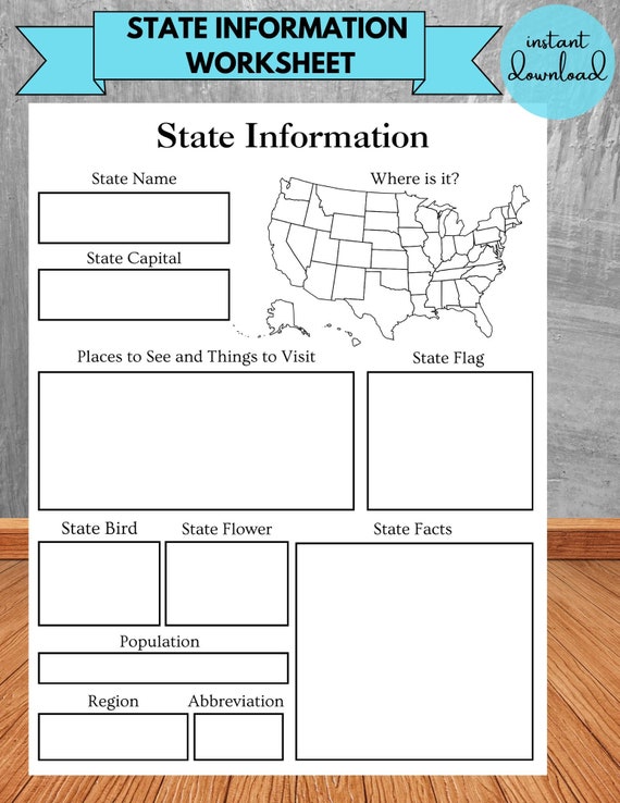
One of the most significant benefits of using a geography coloring page is its ability to boost map learning and spatial awareness. When children color a blank map, they begin to develop a mental picture of the world map. They trace the coastlines of continents and countries, distinguishing their unique shapes and relative sizes. This tactile engagement helps them internalize geographical boundaries in a way that simply looking at a pre-colored map cannot achieve.Consider these ways coloring pages enhance spatial understanding:
- Tracing Boundaries: Physically outlining countries and continents helps solidify their shapes in a child's mind.
- Relative Location: Coloring adjacent countries or continents naturally teaches children about their proximity and relationships.
- Identifying Oceans: Filling in the vast expanses of the oceans reinforces their names and locations around the landmasses.
- Directional Sense: As children work on different parts of a map, they implicitly develop a better sense of cardinal directions.
- Continent Focus: Dedicate a week to one continent, coloring its outline, then individual countries within it.
- Country Deep Dives: Use a coloring page of a specific country (e.g., France or Japan) to identify its major cities, rivers, or landmarks.
- Flags and Symbols: Many printables include national flags or cultural symbols to color, linking geography to national identity.
- Climate Zones: Challenge older children to color different climate zones within a continent, using a key to understand varying temperatures and precipitation.
- Traditional Dress: "What kind of clothes do people wear in this country, and why do you think they dress that way?"
- Iconic Landmarks: "This is the Eiffel Tower in France! What do you know about it?"
- Local Wildlife: "What unique animals live in the Amazon rainforest that you're coloring?"
- Food and Festivals: "What kind of food do you think people eat in this part of the world? Do they have special celebrations?"
- Labeling Exercises: Once colored, challenge your child to label the continents and countries, major oceans, or capital cities.
- Research Prompts: Use the colored map as a visual aid to research a specific country's history, famous landmarks, or unique cultures. "You just colored Italy; let's find out about the Colosseum!"
- Create a "Geography Journal": Bind completed coloring pages into a personalized atlas. Children can add facts, drawings, or even photos related to each region.
- Route Planning: For older children, use a colored world map to trace imaginary journeys or historical exploration routes, discussing distances and modes of transport.
- Pop Quizzes: After coloring, point to a region and ask your child to identify it, reinforcing map learning.
- Age-Appropriateness: For younger children, simple outlines of continents and countries are best. Older children can handle more detailed maps with smaller countries, rivers, and mountain ranges.
- Variety: Look for printables that offer a range of challenges – from simple world map outlines to detailed maps of specific regions or even historical maps.
- Educational Value: Ensure the printables are accurate and offer opportunities for learning beyond just coloring. Some may include fun facts or prompts.
- Accessibility: Choose printables that are easy to print and clear. Black and white outlines are usually best.
- Thematic Sets: Consider sets that focus on a specific theme, like "Animals of the World" or "Famous Landmarks," to integrate other subjects.
- Globes and Atlases: These tangible tools provide a three-dimensional perspective and a wealth of information that complements flat coloring pages.
- Online Interactive Maps: Websites like National Geographic Kids or Google Earth allow children to zoom in on locations they've colored, see real-world images, and explore virtual tours, enhancing their understanding of educational travel. (External Link Suggestion: National Geographic Kids)
- Documentaries and Books: Watch age-appropriate documentaries about different continents and countries or read books that feature diverse cultures.
- Virtual Field Trips: Many museums and cultural sites now offer virtual tours, providing a glimpse into locations your child has colored. This can spark a real interest in educational travel. (Internal Link Suggestion: [Our Guide to Virtual Field Trips for Homeschoolers])
- Geography Games: Incorporate board games or online quizzes that reinforce geographical knowledge in a playful way.
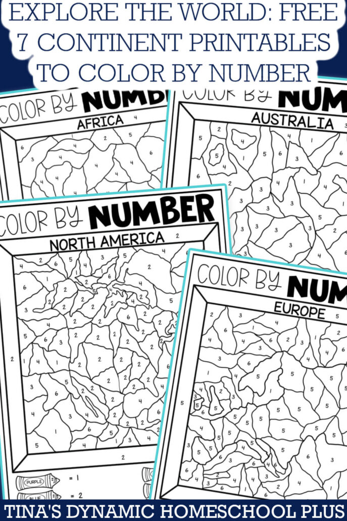
A child happily coloring a world map with crayons, showing different continents in various colors.Close-up of hands coloring a detailed map of Europe, highlighting specific countries.A collection of geography coloring pages laid out on a table, featuring continents, oceans, and cultural elements.A globe, an atlas, and a finished colored map side-by-side, representing complementary learning tools.[Our Guide to Homeschool Social Studies](Anchor text: "homeschool social studies" or "comprehensive social studies curriculum")[DIY Educational Travel Ideas for Families](Anchor text: "educational travel" or "planning educational trips")[Understanding World Cultures: A Homeschooler's Guide](Anchor text: "diverse cultures" or "exploring world cultures")[Best Resources for Map Learning at Home](Anchor text: "map learning" or "improving map skills")[Our Guide to Virtual Field Trips for Homeschoolers](Anchor text: "virtual tours" or "virtual field trips")National Geographic Kids(Anchor text: "National Geographic Kids" or "online interactive maps")UNESCO World Heritage Centre(Anchor text: "UNESCO World Heritage sites" or "cultural sites")CIA World Factbook(Anchor text: "CIA World Factbook" or "country facts")- Title: Discover the World: Engaging Geography Coloring Pages for Homeschool Educators
- Description: Transform homeschool social studies with interactive geography coloring pages! Boost map learning, explore continents & cultures, and make global education fun for kids. Free printables inside!
- Hashtags: #HomeschoolGeography #GeographyForKids #HomeschoolSocialStudies #MapLearning #EducationalPrintables #WorldMap #ContinentsAndCountries #HomeschoolLife #LearningThroughPlay #FreePrintables
This hands-on approach makes abstract cartography concrete, building a strong foundation for more advanced geographical studies later on.
Exploring Continents and Countries Through Color
Imagine a lesson where your child colors each of the seven continents a different hue. This simple activity is a powerful way to distinguish and remember these major landmasses. Beyond just continents, specialized geography coloring page and printables can focus on individual continents and countries. For instance, an outline map of Africa could be colored, then followed by labeling its diverse countries like Egypt, Kenya, or South Africa.Here are some ideas for exploring continents and countries with coloring pages:
This method transforms the study of global political and physical geography into an exciting artistic endeavor, making facts about continents and countries stick.
Bringing Cultures to Life with Creative Coloring
Geography isn't just about physical features; it's intrinsically linked to people and their cultures. Geography coloring page and printables offer a wonderful opportunity to introduce children to the rich tapestry of human diversity around the globe. Many resources feature illustrations of people in traditional attire, famous landmarks, unique animals, or cultural artifacts associated with specific regions.While coloring, you can engage your children in discussions about:
These conversations help children connect geographical locations with the vibrant human experiences that define them. It fosters curiosity, respect, and empathy for diverse cultures, expanding their worldview far beyond their immediate environment. It's a fantastic way to make homeschool social studies truly global and inclusive.
Practical Tips for Integrating Geography Coloring Pages into Your Homeschool Curriculum
Maximizing the educational impact of geography coloring page and printables requires a thoughtful approach. They are most effective when used as part of a broader learning strategy, rather than as standalone activities. Here’s how you can seamlessly weave them into your homeschool social studies curriculum.Beyond Just Coloring: Interactive Activities
While coloring is a fantastic starting point, don't stop there! Think of each geography coloring page as a launchpad for deeper exploration.These activities transform passive coloring into active learning, solidifying knowledge and encouraging independent research.
Choosing the Right Geography Coloring Page and Printables
The market is flooded with geography coloring page and printables, so knowing how to select the best ones is key.Remember, the goal is engagement and learning, so choose resources that will genuinely excite your child about map learning and global discovery.
Complementary Learning Resources for Deeper Exploration
While geography coloring page and printables are excellent, they are even more powerful when combined with other resources.By creating a rich, multi-sensory learning environment, you can foster a deep and lasting appreciation for geography within your homeschool social studies curriculum.
Real-World Impact: Stories from Homeschool Families
The transformative power of geography coloring page and printables is evident in countless homeschooling households. Take for instance, Sarah, a homeschooling mom of two from Oregon. She struggled to get her 7-year-old son, Liam, interested in homeschool social studies. "He just found maps boring," she recalls. "But then we tried a geography coloring page of the world map. He spent an entire afternoon coloring each continent and ocean, and suddenly, he was asking questions about where people lived and what their lives were like." Liam’s engagement soared, and he now eagerly anticipates his geography lessons.Similarly, the Rodriguez family used geography coloring page and printables as a foundation for their unit on educational travel. Their children, aged 9 and 11, colored maps of Europe, identifying key countries and landmarks. This led to them researching different cultures, planning imaginary trips, and even trying out recipes from countries they had colored. "It brought the world right into our kitchen," says Mrs. Rodriguez. "The coloring pages were the spark that ignited their passion for learning about other places and people." These stories highlight how a simple, creative tool can unlock a world of learning and curiosity for children, making geography an exciting adventure rather than a tedious task.
Your Journey to Global Discovery Starts Here!
Embarking on a journey of geographical discovery with your homeschooling students doesn't have to be complicated or dull. With the vibrant and interactive power of geography coloring page and printables, you can transform your homeschool social studies lessons into captivating explorations of our planet. These resources are an incredibly effective way to enhance map learning, familiarize children with continents and countries, introduce them to diverse cultures, and even inspire dreams of educational travel.By engaging their creativity and tactile senses, you're not just teaching facts; you're nurturing a lifelong curiosity about the world and its inhabitants. It's an opportunity to build a strong foundation of geographical knowledge that will empower your children to understand global events, appreciate cultural differences, and become thoughtful, informed citizens of the world.
Ready to bring the world to life in your homeschool?
Explore the world with our free geography coloring resources!
Start your adventure today by downloading our collection of engaging geography coloring page and printables. They're designed to make map learning fun, interactive, and truly unforgettable for your homeschooling journey.--- Image Alt Text Suggestions:
Internal Link Suggestions:
External Link Suggestions:
Social Sharing Optimization:

0 Comments