
Discover the World: Engaging Geography Coloring Pages for Homeschool Educators
Quick takeaway: Geography coloring pages are a simple, low-prep way to teach map skills, continents, countries, cultures, and physical geography to students of all ages. This guide gives homeschool educators printable resource ideas, lesson plans, differentiation tips, assessment strategies, and SEO-friendly classroom resources to bring global learning to life.

Introduction
Are you looking for creative, low-prep ways to teach geography in your homeschool? Coloring pages are more than a quiet-time activity — when designed intentionally, they build map skills, reinforce place knowledge, nurture spatial reasoning, and spark cultural curiosity. In this article you’ll learn how to choose and create high-quality geography coloring pages, align them with learning goals and standards, adapt them for different ages and learning styles, and integrate them into multi-disciplinary lessons. You’ll also find a list of printable ideas, real-world examples, assessment suggestions, technology tools, and classroom-management tips for smooth implementation.
Why Use Geography Coloring Pages in Homeschooling?
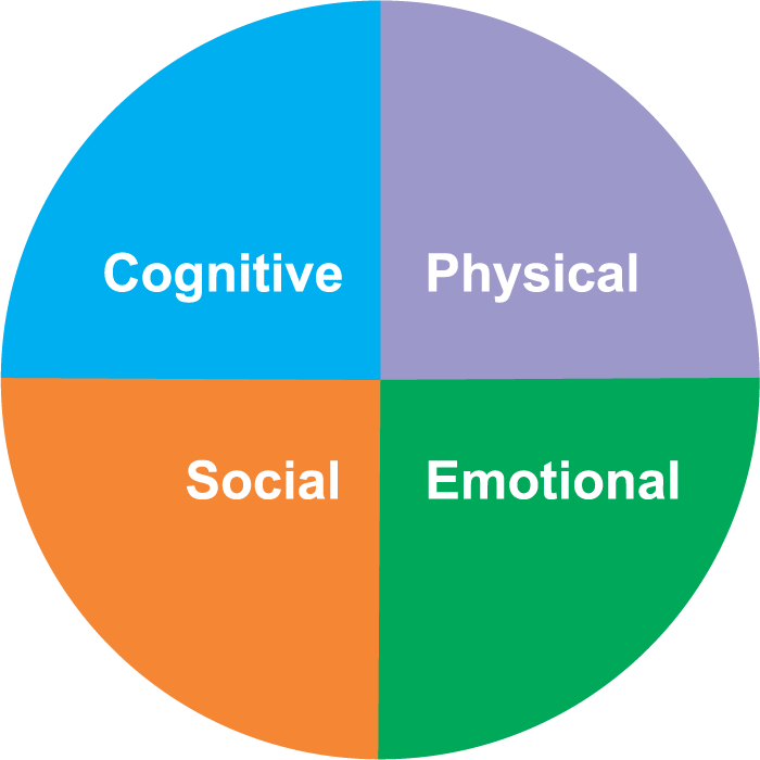
Benefits for cognitive and social-emotional learning
Coloring pages support multiple aspects of learning:
- Visual learning and memory: Coloring maps and labeled features helps students visually encode spatial relationships and place names.
- Fine motor development: Younger students strengthen hand-eye coordination while coloring and tracing borders.
- Engagement and motivation: Coloring combined with stories, music, or hands-on projects increases sustained attention.
- Cultural empathy: Coloring scenes from around the world paired with short biographies or cultural facts fosters curiosity and respect.
- Elementary geography: continents, oceans, map symbols, cardinal directions
- Upper-elementary/middle school: countries, capitals, major landforms, climate zones
- High school intro courses: human-environment interaction, population distribution, geopolitical boundaries
- Keep line art clear and bold so young children can color easily.
- Use simplified shapes for small countries or islands; include insets where necessary.
- Include a legend and compass rose for map literacy practice.
- Label key features but leave space for student-added labels to encourage active learning.
- Provide high-contrast versions and larger-print variants for visually impaired learners.
- Offer black-and-white and grayscale options for printers with limited color capacity.
- Use culturally respectful images and include diverse voices in accompanying descriptions.
- Preschool–K: Bold, simplified maps focusing on large continents and oceans. Add stickers or stamps for engagement.
- Grades 1–3: Add country outlines, major landmarks, animal habitats, and simple labeling prompts.
- Grades 4–6: Introduce coordinates, scale, physical features, and short research activities tied to each coloring page.
- Middle–High school: Use complex thematic maps, data overlays (population, GDP, climate), and source-based questions.
- Objective: Identify the seven continents and five oceans.
- Materials: World map coloring page, crayons, continent stickers, song about continents.
- Activities:
- Sing a continents song to introduce terms.
- Color each continent a different color on the coloring page.
- Match animal stickers to their continents and discuss one fact about each animal.
- Assessment: Quick oral quiz — point to region, student names continent/ocean. Color checklist for teacher.
- Objective: Locate a selected country, identify capital and flag, and present a short report.
- Materials: Country outline coloring page, flag coloring page, research sheet, internet access or library resources.
- Activities:
- Students color the country and flag, label the capital, and mark neighboring countries.
- Research: one paragraph on climate, one paragraph on a cultural tradition, one important geographic feature.
- Share findings: short oral presentation or slide with the colored pages as visuals.
- Assessment: Rubric-based scoring for accuracy of map, clarity of research, and speaking skills.
- Objective: Interpret physical maps and relate features to human activity.
- Materials: Physical geography coloring pages (mountains, rivers, climate zones), data charts (population, land use), calculators.
- Activities:
- Students color climate zones, major rivers, and mountain ranges, then annotate how each feature affects settlement patterns.
- Data task: compare population density with physical features and propose reasons for distribution.
- Extension: Create a travel brochure highlighting how geography impacts tourism and livelihoods.
- Assessment: Written explanation linking map features to human activities, plus a graded mapping accuracy check.
- Continents and oceans coloring page with labeled and unlabeled versions
- Country outline + flag printable bundles (two-page sets: map and cultural vignette)
- Map symbols and legend worksheet
- Latitude/longitude coordinate practice grid pages
- Physical geography layers: mountains, rivers, climate zones (transparencies for overlay)
- “Country report” template with coloring box for flag and map
- Scavenger hunt cards (e.g., “Find a country with a river longer than 2,000 km”)
- Quick map quizzes (point-and-name)
- Sketch-and-explain: students draw a map feature and explain its significance
- Exit tickets: one fact learned, one question they still have
- Country project with map, flag, and short written report
- Map-reading test with coordinates, scale conversions, and legend interpretation
- Portfolio: a binder of colored maps and reflections showing progress over time
- For students with fine-motor challenges: provide thicker crayons, adaptive grips, or digital coloring tools.
- For advanced learners: include data overlays (population, GDP, elevation) and require synthesis tasks.
- For English language learners: pair pages with bilingual labels, picture glossaries, and oral practice.
- For neurodiverse learners: offer clear step-by-step instructions, smaller tasks, and sensory breaks.
- Canva: create custom map templates and printable worksheets
- Google Slides/Docs: distribute coloring pages and collect student work digitally
- GeoGuessr / Seterra: gamified geography practice to pair with coloring activities
- ArcGIS Online (education licenses): for advanced mapping and creating thematic map overlays
- Tayasui Sketches or Procreate (iPad): digital coloring options for students who prefer touchscreen work
- Prepare a “map station” with printed pages, coloring supplies, atlases, and a globe.
- Use a rotation model: while one child completes a coloring activity, another reads a short cultural story or works on a research task.
- Display students’ finished maps to celebrate learning and reinforce memory.
- Incorporate seasonal or current-event tie-ins (e.g., Olympics country study, global holidays).
- Keep a digital archive of completed pages to track growth and create a printed portfolio at year-end.
- Choose resources labeled for educational use or public domain (Creative Commons CC0 or CC BY).
- For commercial or shared co-op use, verify whether a teacher license is required.
- Compress large PDFs for easy printing and email sharing, and offer both single-page and booklet print layouts.
- Target long-tail keywords: “printable world map coloring page for kindergarten,” “continent coloring worksheets homeschool.”
- Use descriptive file names and alt text for images (e.g., world-continent-coloring-page-kids.jpg). Example alt text: “Printable world map coloring page showing continents and oceans with bold outlines for young learners.”
- Create resource bundles and landing pages with detailed descriptions, grade levels, and sample images.
- Offer free previews and gated resources (email signup) to build your homeschool mailing list.
- Share on Pinterest, Facebook homeschool groups, and teacher resource marketplaces using clear hashtags and engaging thumbnails.
- homeschool curriculum planning guide
- downloadable geography printable pack
- how to teach map skills step-by-step
- National Geographic Education — classroom resources and map literacy guides
- U.S. Geological Survey (USGS) — physical geography and topographic resources
- How Maps Work – National Geographic — foundational reading on map projections and symbols
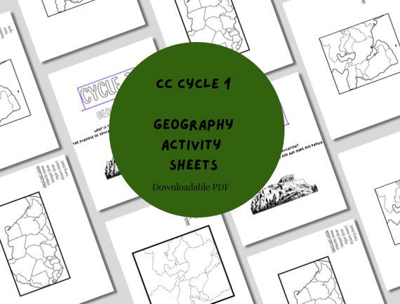
- Image 1 alt text: “Printable world map coloring page with continents labeled and large bold outlines for children.”
- Image 2 alt text: “Child coloring a country outline and flag with colored pencils at a learning table.”
- Image 3 alt text: “Set of printable geography worksheets including coordinate practice and climate zone coloring pages.”

Academic alignment
Geography coloring pages can align with common standards and homeschool goals:
Types of Geography Coloring Pages and When to Use Them
Choosing the right type of coloring page depends on your objective and the student’s level. Below are categories and suggested uses.
1. Basic world maps and continents
Use these with young learners to introduce continents, oceans, and relative location. Activities include coloring continents different colors, labeling oceans, and matching continent animals or landmarks.
2. Country maps and flags
Introduce country shapes, capitals, and national flags. Good for graded reports on a country or “country of the week” units.
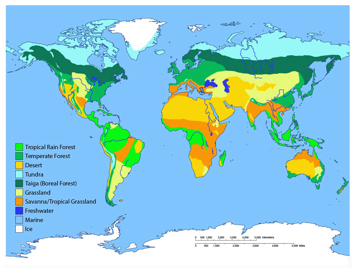
3. Physical geography maps
Include mountains, rivers, deserts, and climate zones. These are effective for lessons on ecosystems, biomes, and Earth’s physical processes.
4. Thematic and cultural pages
Scenes from daily life, traditional clothing, architecture, and cuisine help link geography to culture and social studies.
5. Map skills worksheets (grid, coordinates, scale)
Use for explicit instruction on latitude and longitude, map scale, compass rose, and using grids to locate places.
Creating High-Quality Geography Coloring Pages
Whether you use premade printables or create your own, follow these principles to maximize learning value.
Design tips
Accessibility and inclusion
Age differentiation
Sample Lesson Plans Using Coloring Pages
Below are three sample, ready-to-run lessons (elementary, upper-elementary, and middle school) that incorporate coloring pages and simple assessments.
Lesson 1 – Elementary (Grades K–2): Continents & Oceans
Lesson 2 – Upper Elementary (Grades 3–5): Country Study with Flag and Map
Lesson 3 – Middle School (Grades 6–8): Physical Geography & Data Interpretation
Printable Resource Ideas and Templates
Below are suggested printables to build a comprehensive curriculum unit. These can be offered as PDFs or printed single pages for each activity.
Integrating Coloring Pages into Multi-Disciplinary Projects
Coloring pages fit naturally into project-based learning. Here are project ideas that combine geography with other subjects.
Language Arts + Geography
Have students color a country map and write a travel journal entry from the perspective of a local child. This builds empathy, narrative skills, and geographic knowledge.
Science + Geography
Use climate zone coloring pages with a study of local ecosystems. Students design experiments or observations related to rainfall patterns or temperature differences.
Art + Geography
Turn coloring pages into mixed-media pieces: watercolor background for ocean currents, textured materials for mountain ranges, or collages of cultural symbols.
Assessment Strategies and Tracking Progress
Use both formative and summative approaches to measure geographic learning from coloring activities.
Formative checks
Summative tasks
Differentiation and Special Needs Considerations
Make geography coloring pages accessible and meaningful for diverse learners.
Technology Tools and Printable Platforms
Use digital tools to create, share, and customize coloring pages and activities. These tools increase flexibility and allow for hybrid learning.
Recommended tools
Real-World Examples and Case Studies
Below are short descriptions of how homeschool educators and small co-ops have successfully used geography coloring pages.
Case study 1: The Country Passport Project (K–5 co-op)
Every month, students “visit” a new country. They color the country map and flag, complete a passport page (stamp included), cook a simple recipe, and share a short cultural fact. Outcome: improved retention of country names and increased enthusiasm for cultural studies.
Case study 2: Map Skills Bootcamp (mixed-grade homeschool group)
Over six weekly sessions, students moved from continent identification to reading lat/long coordinates. Coloring layered maps and creating overlays helped learners visualize map projections and spatial relationships. Outcome: measurable improvement in map-reading accuracy on post-test assessments.
Practical Tips for Homeschool Implementation
Copyright, Licensing, and Print Considerations
When using online coloring pages or creating your own, be mindful of copyright and licensing. Follow these best practices:
SEO and Resource Sharing: How to Make Your Printables Discoverable
If you create printable geography coloring pages and want others to find them, follow these SEO suggestions:
Suggested Internal and External Links for Publication
Internal link suggestions (anchor text recommendations):
External authoritative links (open in new window):
Image Recommendations and Alt Text Examples
Include several images to enhance the post: a full-page world map coloring sample, a close-up of a student coloring, and a printable sample thumbnail.
Frequently Asked Questions (FAQ)
How do coloring pages improve geography learning?
Coloring enhances visual memory, reinforces spatial relationships, and provides a low-stress context to practice labeling and map skills. When paired with discussion and research tasks, coloring becomes an active learning strategy.
Are coloring pages appropriate for older students?
Yes. For older learners, use

0 Comments