
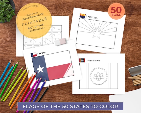
Discover the World: Engaging Geography Coloring Pages for Homeschool Educators
Are you a homeschooling parent or teacher constantly searching for creative ways to make learning come alive? Imagine transforming your child’s social studies lessons from tedious memorization into an exciting, hands-on adventure. Geography, often perceived as a dry subject, can become one of the most vibrant and engaging parts of your curriculum, especially when you introduce the magic of geography coloring page and printables. These simple yet powerful tools offer a unique blend of creativity and education, making the vast world accessible right from your kitchen table.
In the dynamic landscape of homeschooling, educators are always seeking innovative methods to capture their children’s imagination and foster a genuine love for learning. Traditional textbooks can sometimes fall flat, but interactive activities like coloring pages breathe life into abstract concepts. This article will explore why geography coloring page and printables are an indispensable resource for any homeschool social studies program. We’ll dive into how these engaging tools can revolutionize map learning, help children grasp the intricacies of continents and countries, spark interest in educational travel, and even introduce them to diverse cultures and the mysteries of the oceans. Get ready to unleash a world of discovery, one crayon stroke at a time!

Why Geography Coloring Pages Are a Homeschool Game-Changer
Homeschooling offers the incredible flexibility to tailor education to your child’s unique learning style. For subjects like geography, which require understanding spatial relationships and global diversity, a static map in a book might not always cut it. This is where geography coloring page and printables shine, offering a dynamic and interactive approach that caters to visual, kinesthetic, and even auditory learners.

Making Map Learning Fun and Accessible
Traditional map learning can be intimidating for young learners. Distinguishing between political boundaries, physical features, and abstract symbols requires a certain level of cognitive development. Coloring pages, however, break down this complexity into manageable, enjoyable steps. When children color a map, they are actively engaging with its contours, shapes, and regions. This hands-on process helps them internalize geographical information in a way that passive observation simply cannot.
Imagine your child tracing the outline of South America, coloring the Amazon Rainforest green, and labeling the Andes Mountains. This isn’t just an art activity; it’s a powerful mnemonic device. The act of coloring helps cement the visual representation of these places in their memory. They learn to recognize the “boot shape” of Italy or the vast expanse of Russia not as abstract lines but as familiar forms they’ve personally brought to life with color.

A Multisensory Approach to Continents and Countries
One of the greatest strengths of geography coloring page and printables is their ability to engage multiple senses. As children color, they are using their fine motor skills, making decisions about color, and often discussing what they are coloring. This multisensory engagement enhances retention and comprehension, especially when learning about continents and countries.
For instance, when coloring a page dedicated to Africa, they might color the Sahara Desert in shades of yellow and orange, the Nile River blue, and then identify countries like Egypt or Kenya. This active participation transforms passive information into personal experience. They aren’t just memorizing a list of countries; they are visually and kinesthetically connecting with them. This deepens their understanding of relative location, size, and even the unique characteristics of different regions. It’s a fantastic way to build a solid foundation for more advanced geographical studies.

Sparking Curiosity for Educational Travel
Every parent dreams of inspiring a sense of wonder and adventure in their children. Geography coloring page and printables are an excellent catalyst for sparking interest in educational travel. As children color maps of the world, they naturally begin to wonder about the places they are depicting. “What is it like in Australia?” “Who lives in France?” These questions are the seeds of curiosity that can blossom into a lifelong passion for exploration.
By coloring a world map, children start to see the interconnectedness of our planet. They might color the route of a famous explorer, identify countries they wish to visit, or even trace the migratory paths of animals across continents and oceans. This creative engagement makes the world feel smaller and more accessible, fostering a desire to learn more about different places and eventually experience them firsthand. It’s a perfect precursor to discussing potential family trips or simply diving deeper into cultural studies.
What to Look for in High-Quality Geography Coloring Page and Printables
Not all geography coloring page and printables are created equal. To maximize their educational impact in your homeschool social studies curriculum, it’s essential to choose resources that are accurate, comprehensive, and engaging.
Accuracy and Detail: Beyond the Outline
The primary purpose of a geography coloring page is to teach. Therefore, accuracy is paramount. Look for printables that:
- Accurately depict landmasses and political borders: Even if simplified, the shapes of continents and countries should be recognizable and correct.
- Include key geographical features: Rivers, major mountain ranges, deserts, and significant bodies of water (like oceans) should be present and clearly marked or implied.
- Offer various levels of detail: Some pages might be broad outlines of a continent, while others could feature more intricate maps of a specific country with its major cities or states. This allows for progression as your child’s knowledge grows.
- World Map: Essential for understanding global context. Look for versions that can be colored by continent, climate zone, or even population density.
- Individual Continents: Dedicated pages for each continent allow for focused study.
- Specific Countries: Deeper dives into individual nations, highlighting their unique geography.
- Oceans and Major Seas: Don’t forget the vast blue! Coloring pages that illustrate ocean currents, marine life zones, or major shipping routes can be incredibly informative.
- Thematic Maps: Pages focusing on climate, vegetation, population, or even historical empires can add rich layers to your homeschool social studies.
- Traditional Dress: Coloring pages featuring children in traditional attire from different countries.
- Famous Landmarks: Images of iconic structures like the Eiffel Tower, the Great Wall of China, or the Pyramids of Giza.
- Cultural Symbols: Pages with national flags, significant animals, or traditional patterns.
- Younger Children (Preschool-Early Elementary): Simple outlines of continents or a basic world map with large, easy-to-color sections. Focus on broad shapes and primary colors.
- Older Children (Late Elementary-Middle School): More detailed maps with smaller regions, country names, capitals, and even some physical features. These can be used for map learning activities that involve labeling and research.
- Start with a continental outline: Have your child color the overall shape and major surrounding oceans.
- Move to individual countries: Focus on one country per week or day. Use a coloring page of France to learn about its geography, then pair it with a lesson on French cultures, history, and famous landmarks.
- Create a “Geography Wall”: As each page is completed, display it. Soon, you’ll have a vibrant, child-created world map mural illustrating your journey through continents and countries.
- Direction and Orientation: Use the pages to teach cardinal directions. “Color the country north of Mexico blue.”
- Scale and Proportion: Discuss why some countries appear larger than others and how maps represent real-world size.
- Legend and Key: Create your own simple legends for the colors used (e.g., green for forests, blue for rivers).
- “Travel Journals”: After coloring a page of Japan, have your child imagine they are taking an educational travel trip there. What would they see, eat, and do? Write a short journal entry.
- Cultural Art Projects: Research the art styles or traditional crafts of a region they are coloring, then try to replicate them.
- Music and Cuisine: While coloring a map of Italy, play Italian music and perhaps even cook a simple Italian dish. This multi-sensory immersion truly brings cultures to life.
- Pre-Trip Research: Have your child color maps of your destination, identifying key cities, landmarks, and geographical features.
- Route Planning: Color the route you’ll take on a larger map, marking significant stops.
- Cultural Anticipation: Color pages depicting the cultures and traditions they might encounter. This builds excitement and provides context for what they will see and experience.
- Label all the countries in a continent.
- Identify major rivers, mountain ranges, or deserts.
- Mark the capitals of specific countries.
- Locate specific cities they’ve learned about.
- “Guess the Country”: Show a colored country and have your child identify it.
- “Where in the World?”: Describe a landmark or cultural fact, and have them point to the corresponding location on a completed world map coloring page.
- “Continent Challenge”: Time them to see how quickly they can identify all the continents and countries they’ve colored.
- Read-Alouds: As you read a book set in a particular country, have your child color a map of that region.
- Atlases and Globes: Encourage children to compare their colored maps with detailed atlases or a physical globe, helping them understand how two-dimensional representations relate to a three-dimensional world.
Avoid pages that are overly simplistic to the point of being misleading or those with incorrect labels. A good coloring page is a learning tool first and an art activity second.
Comprehensive Coverage: From World Map to Oceans
A truly valuable set of geography coloring page and printables will offer a broad range of topics.
Cultural Elements: Exploring Diverse Cultures
Geography is not just about landforms and borders; it’s also about people and their cultures. High-quality coloring pages can integrate cultural elements, making the learning experience richer and more holistic.
These elements help children connect the geography to the human experience, fostering empathy and an appreciation for global diversity. It’s a wonderful way to broaden their perspective beyond just lines on a map.
Age Appropriateness and Complexity
Consider your child’s age and developmental stage when selecting geography coloring page and printables.
The goal is to challenge without overwhelming, ensuring that the activity remains enjoyable and educational.
Integrating Geography Coloring Pages into Your Homeschool Social Studies Curriculum
Once you have a collection of excellent geography coloring page and printables, the next step is to seamlessly integrate them into your homeschool social studies curriculum. They are far more versatile than just a standalone activity.
Thematic Units: Continents and Countries Deep Dives
Coloring pages are perfect anchors for thematic units. For example, when studying Europe:
This approach makes learning structured, visual, and memorable.
Enhancing Map Learning Skills
Beyond simply coloring, these printables can actively develop critical map learning skills:
Labeling Practice: Provide blank maps for children to label continents and countries, capitals, or major geographical features after coloring. (Internal link suggestion: For more advanced map skills, explore our guide to interactive map projects.*)
Creative Storytelling and Cultural Exploration
Use the coloring pages as a springboard for creative writing and cultural studies.
Preparing for Educational Travel Experiences
If you’re planning a real-world educational travel adventure, geography coloring page and printables are an excellent preparatory tool.
Beyond Coloring: Maximizing the Educational Value
While coloring itself is beneficial, you can extend the learning even further to maximize the value of your geography coloring page and printables.
Labeling and Research Activities
Transform a simple coloring page into a research project. Provide a blank or lightly labeled map and ask your child to:
This encourages independent research using atlases, globes, or online resources, reinforcing their map learning skills.
Interactive Games and Quizzes
Turn the completed pages into fun games:
These games make review enjoyable and solidify knowledge.
Pairing with Books and Documentaries
Integrate coloring pages with other learning materials:
Documentaries: Watch a documentary about wildlife in the Amazon or the history of ancient Egypt, then use a relevant coloring page to reinforce the geographical context. (External link suggestion: Find engaging geography documentaries on platforms like National Geographic Kids or PBS LearningMedia.*)
Free Resources: Your Gateway to Global Exploration
Finding high-quality geography coloring page and printables doesn’t have to be expensive. Many fantastic resources are available for free, making global exploration accessible to every homeschool budget. From simple outlines of continents and countries to detailed world map printables and pages highlighting diverse cultures and the vast oceans, a wealth of educational tools awaits.
These free resources are perfect for enhancing your homeschool social studies curriculum, making map learning an interactive and joyous experience. They provide a wonderful foundation for discussing educational travel and fostering a deep appreciation for our planet.
Ready to embark on an exciting geographical journey with your children? Explore the world with our free geography coloring resources and unlock a universe of learning and creativity today!
Conclusion
The journey of discovery is a cornerstone of homeschooling, and geography offers an endless landscape for exploration. By incorporating geography coloring page and printables into your homeschool social studies curriculum, you’re not just teaching facts; you’re igniting curiosity, fostering creativity, and building a foundational understanding of our incredible planet. These engaging tools transform abstract concepts into tangible experiences, making map learning an adventure, not a chore.
From mastering the shapes of continents and countries to appreciating diverse cultures and understanding the vastness of the oceans, coloring pages provide a multisensory approach that resonates deeply with children. They serve as a powerful springboard for discussions about educational travel, historical events, and the interconnectedness of global societies. So, grab your crayons, print out a map, and prepare to watch your child’s understanding of the world expand in vibrant color. The world is waiting to be explored, one beautiful geography coloring page and printables at a time.

0 Comments