
Discover the World: Engaging Geography Coloring Pages for Homeschool Educators
Are you a homeschooling parent constantly searching for creative ways to make learning come alive? Do you wish you could infuse more excitement into your “homeschool social studies” curriculum, especially when it comes to understanding our vast, incredible planet? You’re not alone! Many educators find that traditional geography lessons can sometimes feel dry, focusing heavily on memorization rather than exploration. But what if there was a simple, colorful, and highly effective tool to transform those lessons into an adventure?
Imagine your child not just learning the names of “continents and countries” but truly connecting with them, understanding their shapes, and even their unique characteristics, all while having fun. This is where geography coloring page and printables come into their own. Far more than just a pastime, these engaging resources offer a powerful, hands-on approach to “map learning” that can captivate young minds, spark curiosity, and build a foundational understanding of the world around them. This comprehensive guide will explore the myriad benefits of incorporating these vibrant tools into your homeschool, offering practical tips, creative activities, and a pathway to making geography an unforgettable journey for your children. Get ready to turn abstract maps into tangible, colorful explorations!
Why Geography Matters in Homeschool Social Studies
Geography is often perceived as merely memorizing capitals and rivers, but its true scope is far broader and immensely valuable, especially within a robust “homeschool social studies” framework. It’s the study of places and the relationships between people and their environments. Understanding geography helps children make sense of current events, appreciate diverse “cultures,” comprehend global trade, and even grasp the impacts of climate change. It’s the lens through which we understand why people live where they do, how resources are distributed, and how human and physical landscapes interact.
When children engage with geography, they develop critical thinking skills, spatial awareness, and a global perspective that is increasingly essential in our interconnected world. It lays the groundwork for understanding history, economics, and even environmental science. For instance, learning about different landforms and “oceans” isn’t just about identification; it’s about understanding their role in ecosystems, weather patterns, and human migration. Integrating “educational travel” concepts, even if only through books and discussions, becomes more meaningful when children have a solid geographical context. By making geography an interactive and engaging subject, we equip our children not just with facts, but with a deeper understanding of humanity’s place on Earth.
The Power of Play: How Geography Coloring Pages Transform Learning
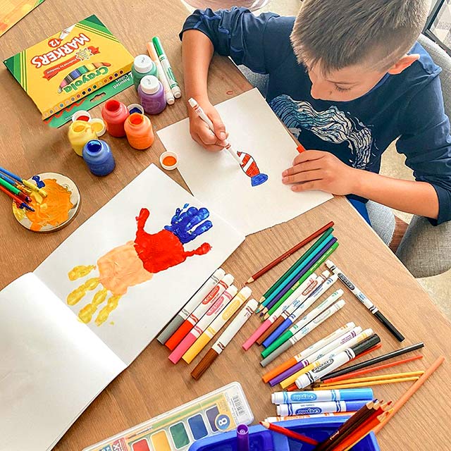
In the world of homeschooling, hands-on learning is a golden standard, and “geography coloring page and printables” are a prime example of its effectiveness. These resources tap into a child’s natural inclination to create and explore, turning what might otherwise be a daunting task of memorization into an enjoyable and memorable activity. The act of coloring itself engages multiple senses and cognitive functions, making learning stick in a way that passive consumption of information often cannot.
When children pick up a crayon and fill in a country on a “world map,” they’re not just coloring; they’re actively processing information. They’re internalizing the shape of the landmass, its relative position to other “continents and countries,” and even developing fine motor skills crucial for writing and other tasks. This active engagement transforms abstract geographical concepts into concrete, personal experiences.

Enhancing Map Learning Through Visual Engagement
One of the most significant advantages of “geography coloring page and printables” is their ability to enhance “map learning” through visual engagement. Traditional maps can sometimes overwhelm young learners with too much detail. Coloring pages, however, simplify these visuals, allowing children to focus on one element at a time.
For example, a child coloring a map of South America might first focus on the outline of the continent, then differentiate between specific “continents and countries” within it by using different colors. This process helps them:
- Recognize Shapes: Children become intimately familiar with the unique outlines of countries and continents.
- Understand Proximity: Coloring adjacent countries helps them grasp relative location and borders.
- Develop Spatial Reasoning: They begin to understand how different landmasses fit together on a “world map.”
- Memory Retention: The kinesthetic act of coloring, combined with visual input, creates stronger neural pathways, making facts easier to recall later.
- Oceans and Seas: Coloring pages depicting the major “oceans” of the world allow children to see their relative sizes and positions. You can discuss the names of the oceans as they color them blue, perhaps even adding marine life illustrations to connect with biology.
- Landforms: Coloring pages featuring various landforms – mountains, rivers, deserts, valleys – help children understand their distinct features. They can use browns for mountains, greens for plains, and blues for rivers, visually differentiating these elements. This hands-on approach builds a stronger mental image than simply reading about them in a textbook.
- Variety of Maps: Look for a range of maps, from a comprehensive “world map” to individual “continents and countries,” and even regional maps. This allows for a progressive learning journey.
- Accuracy: Ensure the maps are geographically correct and up-to-date. Political boundaries can change, so a reputable source is crucial.
- Age-Appropriateness: For younger children, simpler outlines with larger areas to color are best. Older children can handle more detailed maps with smaller countries, capital cities, and even latitude/longitude lines.
- Labels and Keys: Some printables come with pre-labeled features, while others provide blank spaces for children to label themselves, promoting active recall.
- Cultural Elements: The best resources go beyond just geography. Look for pages that include elements of local “cultures,” famous landmarks, traditional attire, or indigenous animals.
- Continent Focus: Use a map of Europe to color each country, perhaps researching a fun fact about each as you go.
- Country Deep Dive: Select a country like Brazil. Color its borders, identify its capital, and maybe even its major cities or geographic features like the Amazon River.
- Advanced Learners: For older children, seek out printables that include flags to color, capital city locations, or even major geological fault lines. This layered approach ensures that “map learning” is continuous and challenging.
- Famous Landmarks: Coloring pages of the Eiffel Tower, the Great Wall of China, or the Pyramids of Giza connect a location to its iconic structures, sparking interest in “educational travel” and history.
- Traditional Dress: Coloring people in traditional attire from different “cultures” introduces children to the diversity of human expression and provides a visual anchor for cultural studies.
- Indigenous Animals/Plants: Pages featuring animals native to specific continents (e.g., kangaroos in Australia, elephants in Africa) help children link geography with biology and ecology.
- Passport Project: Create a simple “passport” booklet. Each time your child “visits” a new country (by coloring its map and learning about it), they get a “stamp” (a small drawing or sticker) in their passport.
- “Continents and Countries” Scavenger Hunt: Hide colored maps of different “continents and countries” around your home. Give clues (e.g., “Find the continent shaped like a boot!”) and have your child find and identify them.
- Cultural Cuisine & Map: As you color a map of a specific country, research and try a simple recipe from that region. This connects taste, “cultures,” and geography in a memorable way.
- Flag Challenge: Print out blank flag templates for various “continents and countries.” As your child colors the country, they can also color its flag, learning about national symbols.
- History: When coloring a map of ancient Rome, discuss the Roman Empire’s expansion. Coloring a map of the Silk Road can lead to discussions about trade and exploration.
- Language Arts: Encourage children to write short stories or poems inspired by the “cultures” or landmarks they are coloring. They can research and write a “travel journal” entry for each colored map.
- Science: While coloring “oceans,” discuss marine life, ocean currents, or the water cycle. When coloring landforms, talk about geology, weather patterns, and ecosystems.
- Art & Design: Beyond just coloring, children can add their own artistic interpretations, drawing in indigenous animals, famous people, or cultural symbols onto their maps.
- Educational Websites: Many reputable educational platforms offer free printables. Look for sites associated with museums, national parks, or educational publishers.
- Homeschooling Blogs and Resource Sites: Fellow homeschooling parents and educators often share their favorite resources and even create their own printables. These can be goldmines for unique and engaging materials.
- Pinterest and Teachers Pay Teachers: These platforms are fantastic for visual searches. You can find specific “continents and countries” maps, “world map” variations, and themed geography packs. Many creators offer free samples or entire free sets.
- Library Resources: Check if your local library offers access to online educational databases that include printable maps and coloring activities.
- Image 1: A child happily coloring a detailed world map with crayons, surrounded by other educational materials.
- Image 2: A close-up of a hand coloring the continent of Africa on a geography printable, showing clear country borders.
- Image 3: A collection of finished geography coloring pages showing various continents, countries, and cultural landmarks, displayed creatively.
- Image 4: A homeschooling parent and child pointing at a colored world map mural on a wall, engaged in discussion.
- “homeschool social studies”: Link to an article on “Developing a Comprehensive Homeschool Social Studies Curriculum.”
- “educational travel”: Link to “Tips for Incorporating Educational Travel into Your Homeschool.”
- “map learning”: Link to “Innovative Strategies for Effective Map Learning in Children.”
- “continents and countries”: Link to “Fun Activities to Teach Continents and Countries to Young Learners.”
- “world map”: Link to “Creative Ways to Use a World Map for Homeschool Geography.”
- “cultures”: Link to “Exploring World Cultures: A Homeschool Unit Study Guide.”
- “free geography coloring resources”: Link to your website’s dedicated page for these printables.
- “National Geographic Kids”: Link to National Geographic Kids website (kids.nationalgeographic.com) for additional geography resources.
- “UNESCO”: Link to UNESCO’s World Heritage Sites list (whc.unesco.org/en/list/) for cultural and historical landmarks.
- “reputable educational platforms”: Link to a well-known educational site like Khan Academy (khanacademy.org) for geography videos or lessons.
- Hashtags: #HomeschoolGeography #GeographyForKids #ColoringPages #HomeschoolSocialStudies #MapLearning #EducationalPrintables #WorldMap #KidsActivities
- Share Text: “Make geography fun and engaging for your homeschoolers! Discover how geography coloring pages can transform map learning and cultural understanding. #HomeschoolGeography #EducationalPrintables”
You can encourage them to label the countries as they color, or even color-code specific regions based on climate, population density, or natural resources. This multi-sensory approach makes “map learning” a truly immersive experience.

Making Abstract Concepts Concrete: Oceans and Landforms
Beyond “continents and countries,” geography coloring pages are excellent for making other abstract geographical concepts more concrete. The sheer vastness of the “oceans” or the towering presence of mountain ranges can be hard for children to visualize without context.
By coloring these elements, children build a vivid mental library of geographical features, making future lessons on ecosystems, climate zones, or human settlement patterns much easier to comprehend.

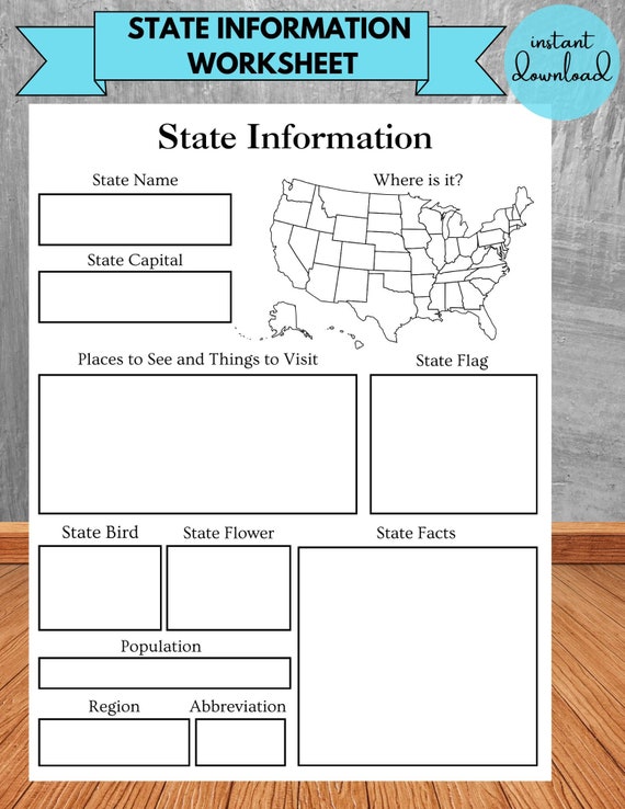
Dive Deep: What to Look for in Geography Coloring Printables
With a plethora of resources available, choosing the right “geography coloring page and printables” can feel a bit overwhelming. As a homeschooling parent, you’ll want to select materials that are not only engaging but also accurate, age-appropriate, and rich in educational value.
When curating your collection, consider these key aspects:
From World Maps to Specific Countries: A Progressive Approach
A great way to structure your geography lessons is to start broad and then narrow the focus. Begin with a world map coloring page, allowing your child to grasp the overall layout of the planet, the major continents, and the “oceans.” This provides a crucial foundational overview.
Once they’ve mastered the global view, you can transition to individual continent coloring pages. For instance, spend a week focusing on Africa, coloring its shape, identifying its countries, and perhaps even its major rivers and deserts. From there, dive even deeper into specific “continents and countries.”
Integrating Cultures and Landmarks for a Richer Experience
Geography isn’t just about lines on a map; it’s about the people and places that define those regions. High-quality “geography coloring page and printables” often extend beyond mere political boundaries to include rich cultural and historical context.
Look for resources that offer:
By integrating these elements, you transform a simple coloring activity into a multidisciplinary learning experience, making geography a vibrant gateway to understanding the world’s rich tapestry of “cultures” and wonders.
Creative Ways to Use Geography Coloring Pages in Your Homeschool
The beauty of “geography coloring page and printables” lies in their versatility. They can be integrated into your “homeschool social studies” curriculum in countless creative ways, turning passive coloring into active learning and exploration. Here are some actionable ideas to inspire your global adventurers:
Crafting a Global Journey: Activity Ideas
* The “World Map” Mural: Print out large sections of a “world map” and have your children color them. Piece them together to create a giant mural on a wall. As you study a new country or continent, they can add details, flags, or even small drawings of landmarks.
Beyond the Crayons: Integrating Other Subjects
“Geography coloring page and printables” are fantastic bridges to other subjects, reinforcing your overall “homeschool social studies” curriculum and making learning holistic.
These integrated activities ensure that geography isn’t an isolated subject but a vibrant thread woven through the entire fabric of your homeschool learning.
Where to Find High-Quality Geography Coloring Page and Printables
The good news for homeschooling parents is that high-quality “geography coloring page and printables” are readily available, often for free! A quick search online will reveal a treasure trove of resources, but knowing where to look can save you time and ensure you’re getting the best materials.
When searching, use specific terms like “free geography coloring page and printables,” “printable world map for kids,” or “continents and countries coloring sheets” to narrow down your results. Look for clear, well-designed images that are easy to print and appealing to your child’s age group.
—
Ready to transform your geography lessons into a vibrant adventure?
Explore the world with our free geography coloring resources! You’ll find a curated collection of engaging “geography coloring page and printables” designed specifically for homeschoolers, making “map learning” and understanding diverse “cultures” more fun than ever before.
—
Embark on a Colorful Global Adventure Today!
Teaching geography in your homeschool doesn’t have to be a monotonous exercise in memorization. By embracing the power of geography coloring page and printables, you can transform your “homeschool social studies” curriculum into an interactive, imaginative, and deeply engaging journey around the globe. These simple yet effective tools empower children to visualize “continents and countries,” understand the vastness of “oceans,” and appreciate the rich tapestry of “cultures” that make up our world.
From the first crayon stroke on a “world map” to detailed explorations of specific regions, “map learning” becomes an active, memorable experience. It fosters creativity, enhances fine motor skills, and builds a foundational understanding of global interconnectedness, preparing your children for a future where global awareness is key. So, gather your crayons, print out a few maps, and watch as your children embark on their own colorful “educational travel” adventure, discovering the wonders of our planet one vibrant hue at a time. The world is waiting to be colored!
—
Image Alt Text Suggestions:
Internal Link Suggestions (Anchor Text):
External Link Suggestions (Anchor Text):
Social Sharing Optimization:

0 Comments